Saturday, August 14, 2010

US Highway 2 Across Montana

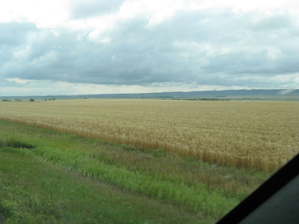
Yesterday, Friday the 13th, we left Glacier National Park and headed east on US Hwy 2. At Browning, Montana the landscape changed completely from mountains to high plains. For 2 days we traveled across Montana - 540 miles. We stopped Friday and spent the night in the Wal-Mart parking lot in Havre, Montana, then continued today on to Williston, North Dakota. Today we also crossed from Mountain Time back into Central Time. Montana is not called the Big Sky Country for nothing!


Although we did see some regular hay and corn fields, the big crop across Montana is wheat. Miles and miles past huge wheat fields.


Hwy 2 is 2-lane across Montana and over each hill it seems like you can see forever.


It was surprising - there were a few cattle farms, but not as many as expected. We did see lots of horses.


As we got into eastern Montana, we left the big wheat farms and other cultivated crops and started seeing a lot more rolling hills. This type of landscape continues into North Dakota.


We plan on being in the Williston area a couple of days, then it will be farther east on Hwy 2.

Thursday, August 12, 2010

Glacier National Park #2

After a day of rest & camping yesterday, today we took a ride on Hwy 2 over to the east side of the national park at East Glacier, then Hwys 49 and 89 to St. Mary and the east entrance. The scenery on this side of the park seems a little different - maybe more open so the majesty of the surrounding mountains seem to stand out more.


The most photographed spot in Glacier National Park is Wild Goose Island in St. Mary Lake.


Another landmark on the east side of the park is Jackson Glacier. Of course, it is receding like the other glaciers in the park. At one time there were over a hundred, now there are only about 25, and they predict that by 2020 they will all be gone.


We drove up to Logan Pass from the east side and the view from this vantage point is awesome.


This whole national park is breathtaking - truly some of God’s greatest beauty. Around every turn there’s more splendor. Here’s a couple more scenery shots just to round out this post.


Tomorrow we’re on the move again.

Wednesday, August 11, 2010

Glacier National Park #1

We spent yesterday, Tuesday August 10, sightseeing in Glacier National Park. Of course, the main attraction and the first place we had to go was up the “Going-to-the-Sun Road” to Logan Pass. It’s about 3300 feet elevation in the campground and is 6646 at Logan Pass, so it’s a pretty good climb, but it’s spread over 30 miles - the steepest part coming the last several miles. The scenery is spectacular and the road, especially near the top, gets very narrow. Even though there is a rock guard wall along the most narrow parts, it pretty tedious - the drop off just over the wall is almost straight down. There was also some road construction up close to the top which caused a little congestion.


At Logan Pass we hiked the Hidden Lake Trail which leaves behind the Visitor’s Center and climbs a board walk for close to a half mile before becoming just a rock & gravel trail for another mile. The trail is out over the tundra and there are all kinds of wild flowers blooming, along with wildlife. We saw Mountain Goats up close and personal, several Big Horn Sheep, marmots, ground squirrels, and birds - Grey Crowned Rosy Finches, Sprague’s Pipits, and American Pipits.


And also for our viewing pleasure were several glaciers and snow patches, not to mention the panoramic views of the surrounding mountains and the awesome “Going-to-the-Sun Road” that you could see snaking along the sides of the mountains going back down. Truly spectacular, awesome, some of God’s finest grandeur!


Here’s a couple more scenery shots.


There’s too much to try to get it all in one blog update - this is just the west side. I’ll probably do another update for the east side later.

Monday, August 9, 2010

Lewiston, ID to Glacier National Park - Montana

On Friday, August 6th , we left Lewiston, Idaho and drove north on Hwy 95 through Moscow and Coeur d’Alene to Bonner‘s Ferry, Idaho. There we took US Hwy 2 east a few miles and spent 1 night at a commercial RV park --total 212 miles. Lots & lots more wheat fields for many miles up close to Coeur d‘Alene, then into a lot of forested terrain.

Saturday, we continued east 42 miles on Hwy 2 to Libby, Montana - back into Mountain Time. We spent two nights in Libby - went to the Libby Baptist Church for Sunday worship service. It was the same very friendly congregation as when we visited here in 2008. They made us feel so welcome!

Today, Monday, we continued east from Libby on Hwy 2. We passed several beautiful lakes - the water was like glass and the reflections were awesome.


Hwy 2 took us through Kalispell, Montana to West Glacier and Glacier National Park. This is one of our favorite National Parks and we got a campsite at Apgar Village. We will be here a few nights and I will probably do another update to the blogfrom here before we leave.

Thursday, August 5, 2010

The Snake River & Hell's Canyon - Lewiston, Idaho

On Monday, August 2nd , we left Walla Walla, Washington and drove Hwy 12 to Lewiston, Idaho -- 105 miles. The drive was through lots and lots of dry-land wheat farming country. The terrain is very hilly, but even though the hills are fairly high, they are more of the rolling variety and the farmers plant the wheat right up and down and all around them.


Yesterday, Wednesday we took an all-day tour boat ride up the Snake River through Hell’s Canyon. The boat is a 32 foot aluminum-weld flat-bottom jet boat - powered by 3 Chevy 350 engines. The captain, Butch, was a very experienced river pilot and Shaun was the 1st mate.


We left the marina a little before 8:00 AM and went a total of 92 miles (one way) up the river through the canyon with mountains towering high on both sides. The scenery of all the rugged mountains and wilderness landscape on either side of the river was absolutely awesome.


Over a distance of 92 miles there was, obviously, stretches of smooth water, but there was also lots of white water - most of the rapids were Class 1, 2, or 3. Rafting is a big business through Hell’s Canyon and we met lots of rafters and kayakers. Just before our turnaround point we ran a set of Class 4 rapids - wow, what an experience in a jet boat!


It was really amazing how Butch maneuvered the boat through the white water - he knew just how to turn into the rough water and feather the engines to get through. Even so, it got pretty rough a few times and the folks in the back of the boat got pretty wet (they weren’t complaining).


We also saw wildlife - at several different places we saw Rocky Mountain Big Horn Sheep and Mule Deer.

BIG HORN SHEEP PICTURES


We also got a new bird to add to our life list - a Chukar (rhymes with tucker). There was a whole flock of them at one spot with lots of young ones.


Butch made an effort to tell some of the history of the area and also some geology lessons. At one place he pulled into shore to show us petroglyphs on a rock carved there by some ancient natives.


It was a long, tiring day, but truly an amazing experience. It was advertised as an all day trip - and it was. As mentioned, we left a little before 8:00 and didn’t get back to the marina until about 5:15 PM. Even though we took time out for breakfast, lunch, and a swim (plus slow downs for the captain to talk history and geology), most of the day was riding the river - and LaVerne is still wondering if Butch had a speed other than “wide open”. Actually I asked him, and the normal cruising speed (rapids and all) was about 35-37 MPH - those 3 Chevy engines were on 3000 RPM a lot of the day.

WHAT A GREAT BOAT TRIP!!

Sunday, August 1, 2010

Walla Walla, Washington

On Friday, July 30th, we left Bullards Beach on the Oregon Coast and had the first of two days of travel. We back-tracked north on US 101 to Florence, took Hwy 126 east to Eugene, north on I-5 to Exit 153 just south of Salem. There we took Hwy 22 and Hwy 214 east about 20 miles to Silver Falls State Park - 223 miles total. This state park boasts 10 water falls and a 7.5 mile hiking trail to view all of them. We were only there for one night and we didn’t do the 7.5 mile hike, but we did walk a quarter mile or so to see the South Falls - a beautiful 177 foot falls into a scenic pool.


Yesterday, Saturday, we left Silver Falls State Park, back on Hwy 214 for 15 miles to Silverton, Hwy 213 to Oregon City, I-205 north to I-84, east back through the Columbia River Gorge to I-82. I-82 east took us to Umatilla, Oregon, where we hit Hwy 730 past the McNary Lock & Dam on the Columbia River, then Hwy 12 into Washington to Walla Walla - total 297 miles. Above the McNary Lock & Dam the river is fairly wide and the road follows along really close.


Today, Sunday, was a day of worship and rest. We went to the Trinity Baptist Church in Walla Walla, then had a relaxing restful afternoon. Tomorrow it’s on to Lewiston, Idaho.